
Contact Us
Titi Onabanjo, Project Manager
Transportation Planning
Email: [email protected]
Dmitry Kharena, Planner
Community Planning
Email: [email protected]

Engage Hamilton
Road Classification and Right-of-Way Study
Provide your feedback on the Road Classification and Right-of-Way Study to modernize how our streets are defined, planned, and designed.
The City of Hamilton is undertaking the Road Classification and Right-of-Way Study to modernize how our streets are defined, planned, and designed. This work builds on the 2018 Citywide Transportation Master Plan and the Complete Streets Design Guidelines, advancing the City’s goals for safety, sustainability, equity, and climate resilience.
About the Study
The 2018 Citywide Transportation Master Plan (TMP) identified 71 supporting actions to advance the City’s Strategic Plan vision, goals, and objectives. Among these, the implementation of Complete Streets Design Guidelines was recognized as a transformative initiative. Specifically, Action 37 directs the City to harmonize the road classification policies in the City’s Urban and Rural Hamilton Official Plans with the Complete Streets approach by making amendments to the Official Plans.
Study Purpose
The Road Classification and Right-of-Way Study aims to modernize how the City defines and manages its road network to reflect contemporary transportation, land use, and environmental objectives. It integrates Complete Streets principles, climate adaptation strategies, and equitable design considerations into the City’s planning framework.
Traditional road classification systems primarily focus on vehicle movement, transit operations, and goods delivery. However, urban streets now serve multiple purposes, providing access, supporting place-making, enhancing public health, and fostering environmental resilience.
What are we doing?
- Integrating road classifications and Complete Streets Guidelines
- Establishing appropriate rights-of way widths through decision-making frameworks and supporting policies such as Equity Framework, Urban Design Policies, Greenspace, Facilities/Urban Forestry Guidelines and Secondary Plans
- Undertaking an Official Plan Amendment
Official Plan Amendments
The City’s Urban and Rural Hamilton Official Plans are the primary policy documents that provide direction for the City’s transportation network and help to implement the Transportation Master Plan. Following public and community partner engagement and consultation with Indigenous communities and industry partners, the recommendations of the Road Classification and Right-of-Way study will be implemented by making updates to the City’s Official Plans. The intent of the Official Plan Amendments (OPAs) will be to:
- Improve clarity and consistency of Right-of-Way policies.
- Update daylighting triangle requirements to align with designated Right-of-Ways rather than Road Classification.
- Integrate “Complete Street” road typologies and design principles that supports multimodal travel, safety, and livability into the Official Plans;
- Update Right-of-Way widths and standards to ensure consistent implementation through the Official Plans; and,
- Update Official Plan maps to reflect changes to road classifications.
Functional Road Classification
Groups streets into types based on volume and land access:
- Arterial roads (Major and Minor): Designed to carry higher volumes of traffic across the city. These are the main routes for moving people and goods across the city. They have frequent transit service (such as major bus routes), cycling facilities like protected bike lanes and a mix of nearby shops, services and businesses.
- Major Arterial: moves higher volumes of traffic across the City
- Minor Arterial: moves lesser traffic volumes than Major Arterial across the City
- Collector Roads: Connects neighborhoods to the City’s major and minor arterial roads. They balance both mobility and access, allowing travel between destinations while also providing direct access to homes and businesses. These roads typically carry moderate level of traffic and often include transit routes and cycling facilities. They are commonly located in mixed use areas, serving schools, residential communities and local businesses.
- Local Road: These are roads with lower levels of traffic that provide direct access to homes. They are typically used for shorter trips, and they prioritize walking and biking.
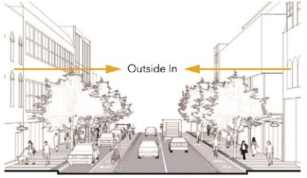
Complete Streets Design
Roadways that are planned and designed to balance needs of all road users including pedestrians, cyclists, people with mobility needs and children:
Transitioning Avenue
- Streets designed for high people and goods movement.
- Lots of space for transit amenities, sidewalks, and tree boulevards.
- Example: Rymal Rd E
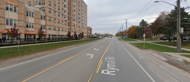
Rymal Road East in October 2020. Source: Google Maps
Urban Avenue
- Streets designed to move people with an emphasis on biking, walking and transit.
- These are people focused streets.
- Example: Cannon St
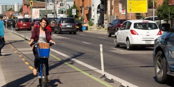
Cannon Street West in Central Hamilton
Main Streets
- Streets designed with a focus on people, shopping and placemaking.
- These are traditional shopping streets, with restaurants, small sized retail and high pedestrian traffic.
- Example: Locke St
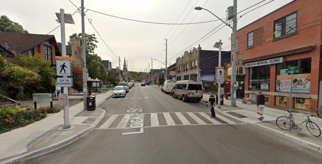
Locke Street in Central Hamilton. Source: Google Maps
Connector
- Streets designed to link neighborhoods to the major streets. Commonly found in residential and school areas.
- Designed to have low traffic speeds through traffic calming.
- Their focus is transit, walking, biking and can sometimes have on-street parking. They can also have buffered side-walks and/or bike lanes to protect from vehicular traffic.
- Example: Sterling St
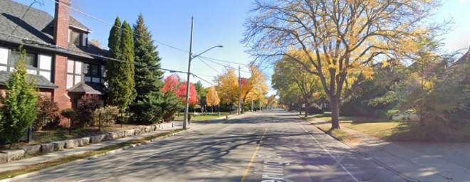
Sterling Street. Source: Google Maps
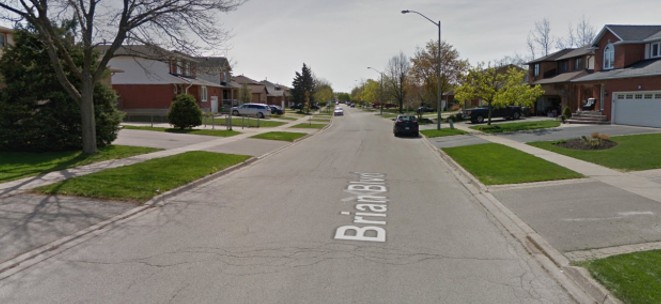
Neighborhood Street
- Streets designed to provide direct residential access.
- Designed to have low traffic speeds through traffic calming and accommodate high pedestrian traffic.
- Example: Brian Blvd
Brian Boulevard. Source: Google Maps
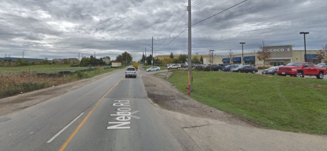
Industrial Street
- Designed for goods movement and truck routes.
- Example: Nebo Rd
Nebo Road at Rymal Road. Source: Google Maps
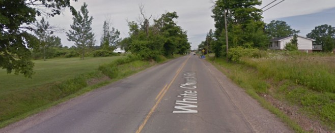
Rural Roads
- These are roads located outside the urban area, primarily within the agricultural and rural areas of the City.
- Designed to serve slow moving agricultural vehicles and can sometimes feature transit and bike lanes.
- Example: White Church Rd
White Church Road. Source: Google Maps
Difference between Functional Classification & Complete Streets
- Functional classification describes the primary purpose of the street based on volume and land access, i.e movement vs land access.
- Complete Streets informs the design of the street based on the primary purpose, neighbourhood context and land uses. Complete Streets design considers sidewalk widths, type of bike facilities and width of travel lanes. Complete Streets help determine Right-of-Way (ROW) and Right-of Way Widths.
THEN
Auto-Mobility
Automobile Safety
NOW
Multi-modal Mobility + Access
Public Health/Safety
Economic Development
Environmental Quality
Livability/Quality of Life
Equity
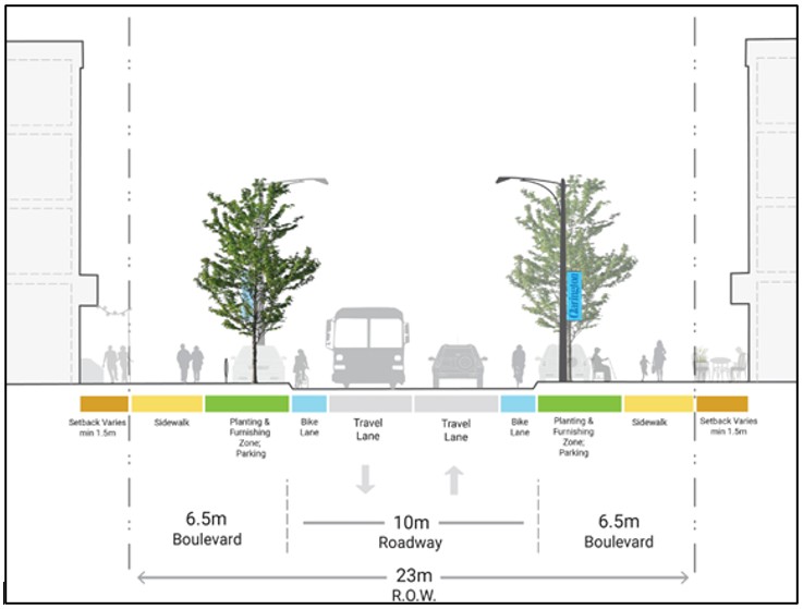
Right-of-Way (ROW) & Right-of-Way Widths
- ROW and ROW widths: refers to the public lands for roads, sidewalks, boulevards, bike lanes trees, and utilities (under or above street)
Date modified