
Sign up to Keep Updated!
You can sign up for email updates to keep up to date about the Neighbourhood Plans Review.
Contact Us
Dmitriy Kharena
Community Planner - Project Lead
Sustainable Communities
Email: [email protected]

Engage Hamilton
We want to hear from you!
The City is reviewing Neighbourhood Plans to ensure they remain relevant, clear, and reflective of community needs. To aid in the review, the City has developed a set of preliminary review criteria.
We want your feedback on the proposed review criteria and how they should be applied.
Neighbourhood Plans are land use guidance documents at the neighbourhood scale that were developed from the late 1960’s to the early 1990’s in the former Municipalities of Hamilton, Dundas and Stoney Creek. They are usually comprised of a map but are sometimes accompanied by a text document containing details on local demographics, the consultation process for the plan, and direction and actions for implementation on matters related to property standards, traffic, local environmental concerns, social programs, recreation and crime. Neighbourhood Plans can be implemented through the Official Plan, including Secondary Plans, through Zoning By-laws, and through other City Master Plans, strategies and initiatives.
Neighbourhood Plans do not form part of the City’s Urban Hamilton Official Plan, however there are policies in the Official Plan that refer to the type of guidance that they may provide, and how amendments to Neighbourhood Plans are to be considered.
Not every neighbourhood has a Neighbourhood Plan. There are currently 71 active Neighbourhood Plans in Hamilton.
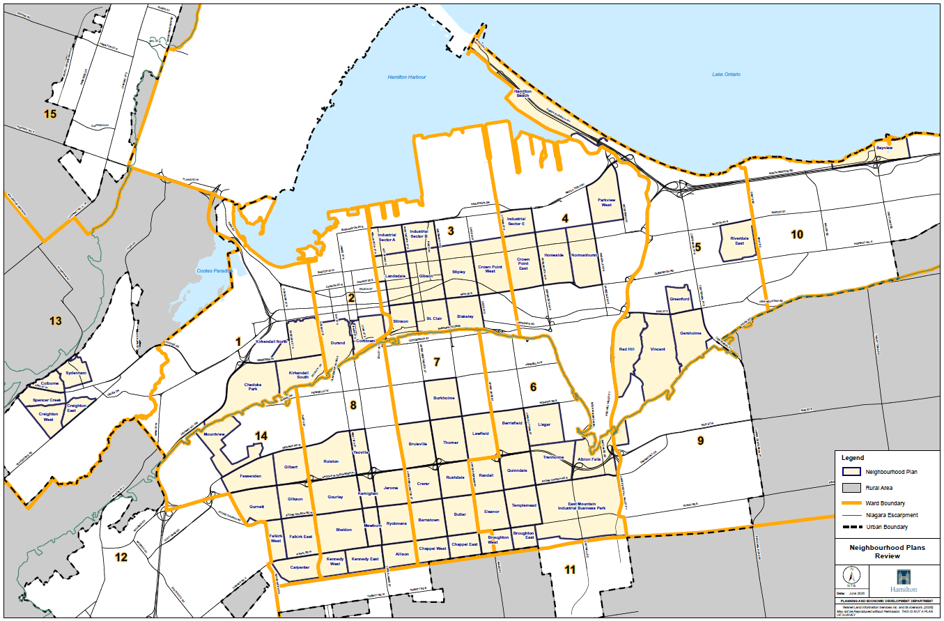
Neighbourhood Plan Maps
- Overall Neighourhood Map
- Dundas Neighbourhood Plans
- Hamilton Neighbourhoods Plans
- Stoney Creek Neighbourhood Plan
Note: Neighbourhood Plan text documents are not currently available in an accessible format. To request to view a text document please contact staff.
Date modified